This case should interest anyone trying to find the location of his ancestor’s house. We found two, very detailed, plat maps of Drohobych, to identify the exact position of a few houses. We already knew the numbers from the vital records from Drohobych. At first glance everything seemed to be ok. On both maps the numbers of houses around the marketplace looked the same to us. However, we later noticed that most of the numbers were different — e.g. north-east of the marketplace (compare the images below). What is most interesting is that both maps are from the same year — 1853. Is it possible that the Municipality of Drohobych changed only a part of the house numbers? Hard to say without further research.
Conclusion: always check twice (or even three times) before you take a picture of one of your “ancestor’s houses”…
Downolad the plat map of Drohobych from 1853, version 1.
Download the plat map of Drohobych from 1853, version 2.
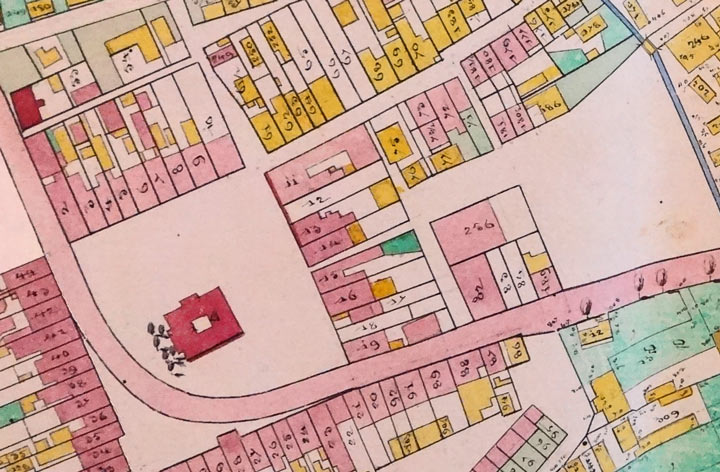
The map of Drohobych, 1853, version 1.
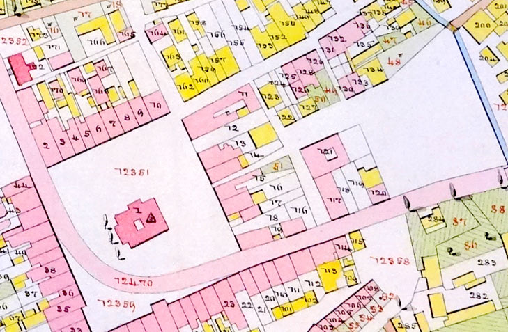
The map of Drohobych, 1853, version 2.
